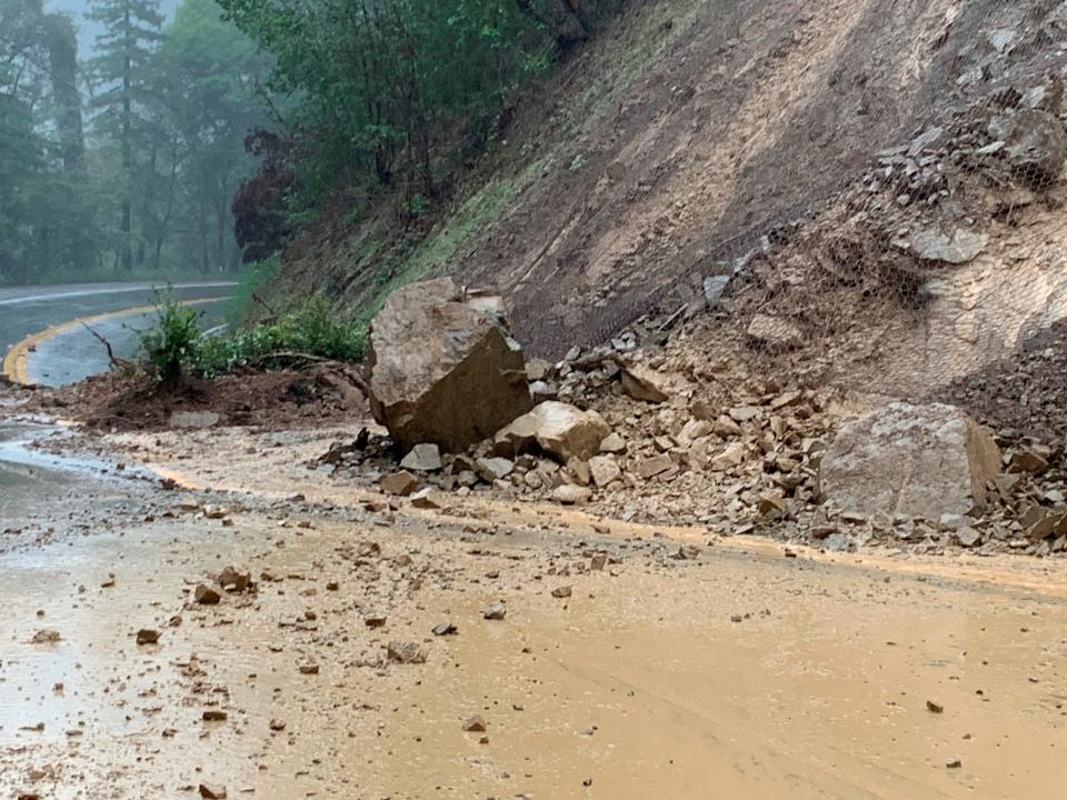
California sees landslides, flooding, snow amid intense storm
LOS ANGELES – California saw intense flooding and landslides across the state Friday as a wave of tropical moisture moved across the drought-stricken West from the Pacific Ocean.
The storms, the result of an atmospheric river of moisture — a long and wide plume of moisture pulled in from the Pacific, led to landslides of rock and mud closing multiple roads in the San Francisco area, between Fremont and Sunol, as well as in Mendocino County near the unincorporated community of Piercy and in the Mendocino National Forest.
It was just the start in a series of storms forecast to move across the West Coast and usher in the new year, according to forecasters at Accuweather.
Anywhere from 8 to 16 inches of rain are forecast across Northern and Central California over the next several days, with some locations seeing the potential for up to 20 inches Friday and Saturday, according to Alex Sosnowski, a senior meteorologist at AccuWeather. In San Francisco, 2 to 4 inches of rain was forecast and another 4 to 8 inches was predicted for Sacramento, Sosnowski added.
Alameda SR-84 (Niles Canyon Road) closed btwn Old Canyon Rd. in Fremont to Main Street in Sunol. (EB local traffic allowed to Palomares Rd.) Caltrans crews removing landslide. No ETO. pic.twitter.com/vKWqHizGH3
— Caltrans District 4 (@CaltransD4) December 30, 2022
The storms are also forecast to drop more than 4 feet of snow in the Sierra Nevada , upping the chances of avalanches as snow levels shift, AccuWeather said, though forecasters say only the highest mountain peaks — higher than 8,000 feet — would likely be impacted by the snow.
The current system is expected to be warmer and wetter, while next week’s storms will be colder, lowering snow levels in the mountains, said Hannah Chandler-Cooley, a meteorologist at the National Weather Service in Sacramento. But the washing away of snow also raises the chances of flooding in nearby communities.

The rain and snow could help slightly to replenish diminishing reservoirs but likely won't be enough to make up for another dry year in California. The past three years have been the state's driest on record.
Local officials across Northern and Central California warned residents of the weather, with officials in Sacramento County advertising sandbag locations and the city of Stockton opening shelters to help residents combat the cold weather and heavy rainfall.
MORE IN THE STOCKTON AREA: Flood watch issued in San Joaquin Valley, Northern California ahead of weekend storm
"We haven't had a lot of water in a long time," city spokesperson Connie Cochran said. "In these conditions, you have to drive more carefully. Slow down. If you do encounter areas where the local streets are flooded or there's standing water, avoid driving through it. Don't drive through standing water."
One of our forecasters took a tour of the Humboldt Bay area to check for flooding. Here are some photos from Hookton Slough (top two photos), Freshwater Creek (bottom left), and Jacoby Creek (bottom right). Please don't drive through flooded roadways! #cawx pic.twitter.com/SJFMTJ2gdz
— NWS Eureka (@NWSEureka) December 30, 2022
Sacramento’s fire officials planned to broadcast evacuation announcements from a helicopter and a boat along the American River — a spot where many unhoused people live in encampments — to warn of flooding.
Humboldt County, where a 6.4 magnitude earthquake struck on Dec. 20, also saw roadways begin to flood, according to the National Weather Service’s Eureka office. A bridge that was temporarily closed last week due to earthquake damage may be closed again if the Eel River, which it crosses, gets too high, officials said.
Contributing: Hannah Workman, The (Stockton, Calif.) Record; Associated Press
This article originally appeared on USA TODAY: California weather: Storms bring landslides, flooding; snow forecast


