5 dead, 2 tornadoes confirmed, 430K without power after storms rip through Michigan
Two confirmed tornados hit lower Michigan as storms raged Thursday night, and assessments of other possible tornadoes were still underway noon on Friday, according to meteorologists at the National Weather Service.
EF-1 tornados are the second weakest types of tornados, according to the National Weather Service website.
Though the rating of the severity of the storm was still under review, one tornado that struck in the Rockford area, north of Grand Rapids, was preliminarily believed to be an EF-1 tornado, said Bruce Smith, meteorologist in charge for the National Weather Service in Grand Rapids.
Another tornado, suspected to have been even stronger, hit in the Williamston and Webberville area of Ingham County and reportedly flipped numerous cars along I-96, Smith said. Smith did note, however, that while it is currently believed that a single tornado crossed from Ingham County into Livingston, there is some speculation there could have been two tornados in that area.
The rating of that tornado is still being reviewed, said Smith. However, it was an EF-1 as it crossed into Livingston County, said Steve Freitag, meteorologist at the National Weather Service based out of White Lake Township.
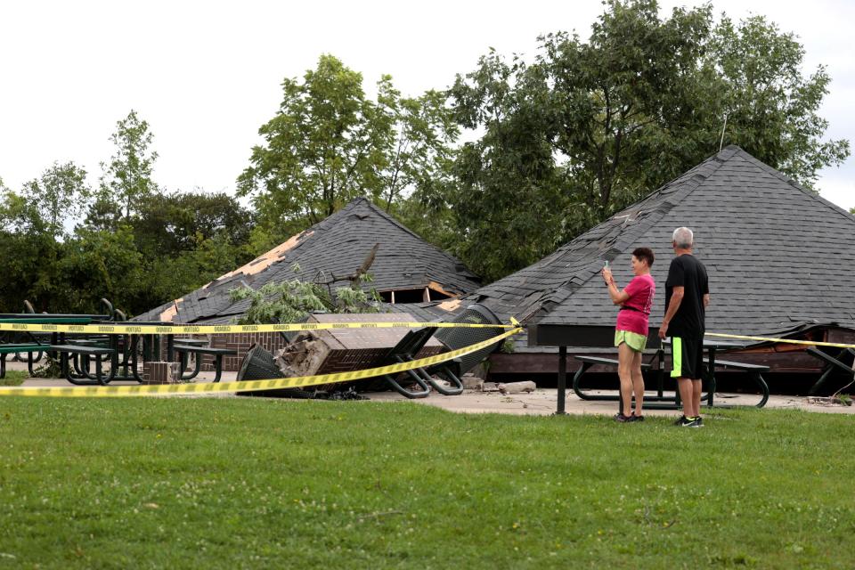
The worst of the storms that strafed Michigan on Thursday passed through the state just before midnight, and left destruction in their path: flooded freeways and communities, downed power lines and trees, damaged cars and structures — and injuries and deaths, including a fatal crash that killed a woman and two children.
"The last two days, have been extremely active compared to what we typically see in Michigan," Steve Considine, a senior National Weather Service forecaster in White Lake Township, said. "This time of year, it's severe weather season."
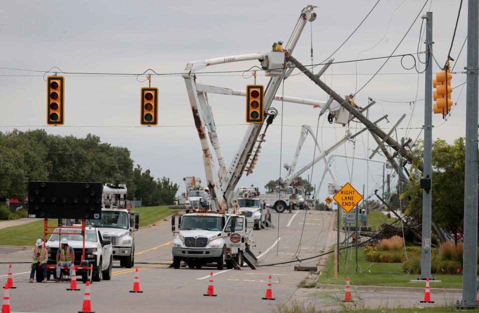
Overnight, the number of power outages grew. Around 12:15 p.m. Firday, the state's two largest utility companies were reporting approximately 430,000 customers without power. DTE reported over 250,000, and Consumers Energy had over 178,000.
As of Friday morning, FlightAware reported 60 delays and 23 cancellations at Detroit Metro Airport.
There was more rainfall during Wednesday night's storms, up to 7 inches, which caused flooding that cut off access to McNamara Terminal at Detroit Metro Airport for hours and put Canton underwater; but more wind, up to 70 mph, Thursday, which explains the surge of downed power lines and trees.
And by early Friday, Michiganders woke up to a mess.
Tornado touches down
In Ingham County, near Williamston and Webberville, a tornado touched down near Interstate 96. It may have moved into Livingston County, weather service forecasters said. It reportedly destroyed barn and houses and injured people in cars and trucks on the freeway.
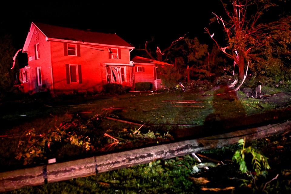
More: Ingham County officials say radar indicates tornado touched down near Williamston
So far, the weather service said, there were no reports of injuries to people in houses.

In addition, the weather service said, there may have been tornadoes in Canton, Plymouth Township and Newport. The weather service plans to survey all the areas in the light of day to determine the damage and whether there was a tornado touchdown or damage from a windsurge or spin up.
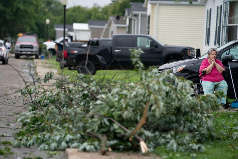
In Frenchtown Villa, a mobile home park in Newport, winds reportedly flipped over some residences.
And on the west side of the state, the Kent County Sheriff's Office was investigating a fatal crash that occurred during the storms that left one woman and two children dead, WZZM-TV reported. Two cars were traveling in opposite directions when one of the vehicles hydroplaned and crashed into the other.
Three passengers in one of the vehicle were killed, one adult woman and two children, the sheriff's office said. The driver of that vehicle suffered a head injury, the the driver of the other vehicle also was injured. There were no passengers.
State of emergency
Just hours before Thursday night's thundershowers, the governor declared a state of emergency, promising to "get first responders and emergency crews on the ground the resources they need to keep people safe," and that "we will get through this together."
And then came the ominous clouds, and eventually the rain and lightning, which lit up the dark sky with flashes of crackling lightning. For part of the night, much of the state was under severe thunderstorm and tornado alerts. TV news stations broke into broadcasts to report what was happening.
More: Michigan power outage map: How to check your status
At about 11 p.m., after the Jonas Brothers concert in at Little Caesars Arena in Detroit, one concert-gower tweeted, with a photo, that "security is advising people to stay inside and not leave the venue until the severe weather moves out of the region."
Overnight, the Michigan Department of Transportation said on social media that flooding closed southbound I-275 at I-94 Lanes, adding that all lanes were blocked and warning not to drive through the water. On eastbound I-96 after Livernois, a crash blocked lanes.
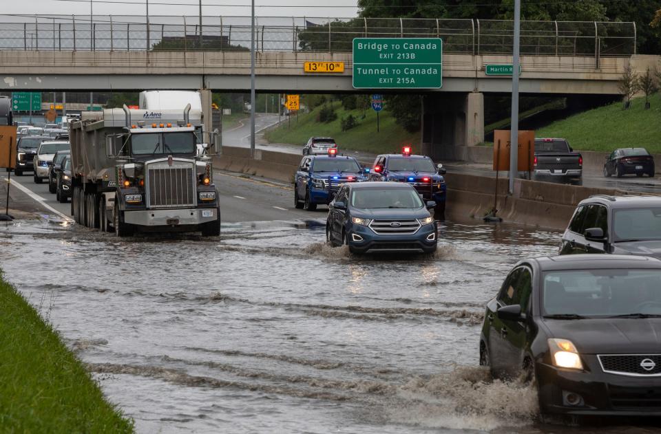
The storms, forecasters said, had dropped another 1-2 inches of rain, saturating the already soaked ground.
Wayne County Executive Warren Evans is expected to declare a state of emergency in response to the severe weather. A press conference is scheduled for Friday morning. Wayne County is providing more than 700 emergency kits and aid to western Wayne and Downriver communities at 8 a.m. on Friday, according to a Facebook post from the county. Downriver residents can go to the Brownstown Fire Station 3 at 20385 Gibraltar Road in Brownstown Township. Western Wayne residents can go to the Wayne County Health Administration Building at 33030 Van Born Road in Wayne.
Contact Frank Witsil: 313-222-5022 or fwitsil@freepress.com.
This article originally appeared on Detroit Free Press: Michigan storms: 5 dead, 2 tornadoes confirmed, 430K without power


